Herramientas/Tool Index
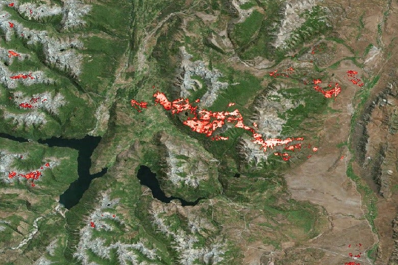
Burned area detection
What is it?
The burned-area-detection project aims to identify and analyze the affected areas after a fire (from images Sentinel-2 satellite data), which allows us to understand the incident in order to take action quickly, using the Python libraries: satproc and unetseg.
Why was it developed?
To provide a tool that makes it easy for a data scientist or learning engineer, the task of preparing the data that will train a machine learning model for satellite images or areas (task that it is sometimes long and cumbersome).
Why are we sharing it?
CBecause there are currently various sources of image data built from satellites and to obtain relevant information from the images they must be processed and worked carefully, which generate data and knowledge to inform decision-making and have a concrete impact.