Herramientas/Tool Index
Mapeo
What is it?
It is an application that makes it easy to document environmental and human rights information and collect data about your land. It is particularly good for working in remote environments and without an internet connection.
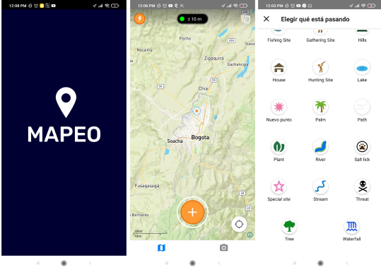
The Mobile Mapping application is used to collect evidence in the field, take photographs or record GPS points of significant places.
The Mapeo Desktop application is used to organize the data collected with cell phones or GPS devices, and to view, edit and create reports on what actions can be taken, which would be difficult to do from a cell phone.
Why was it developed?
Mapeo was built to help indigenous communities document activities that pose a threat to them, such as illegal gold extraction, oil contamination and poaching, in order to carry out community actions against them, report them to the authorities , file lawsuits, launch media campaigns or create maps to claim territorial rights.
Why are we sharing it?
Because this application works offline, it makes it easier for communities that do not have an internet connection to create maps and configure them in a personalized way, having total control in the exchange of data since synchronization only occurs between members of a same project.
It also offers cryptographic security in the data that is collected, preventing it from being falsified and / or manipulated.
Another of its facilities is that it can be translated into any language.

