Herramientas/Tool Index
MAIIA
What is it?
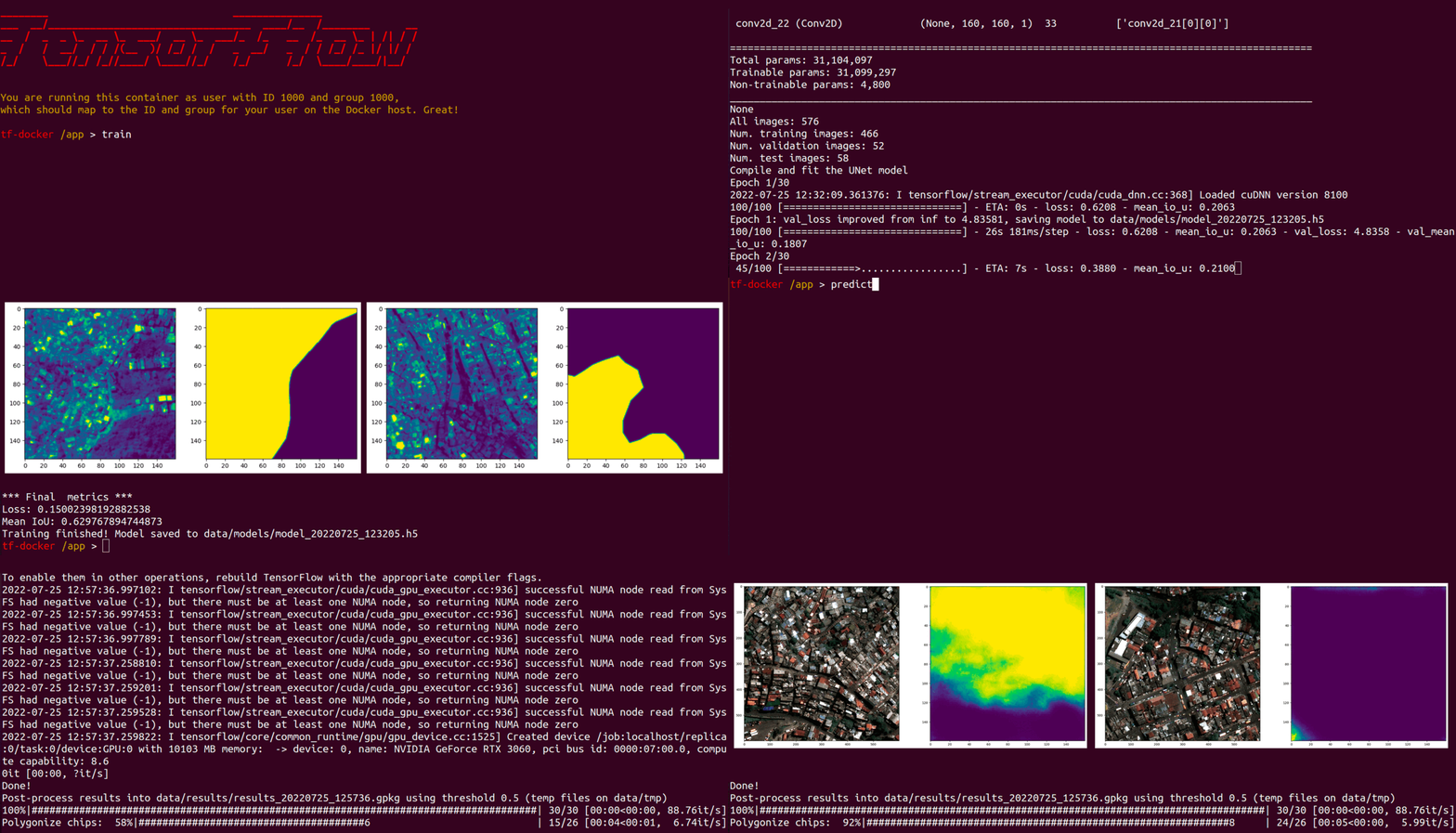
MAIIA is an algorithm that makes it possible to automatically map the location of informal urban settlements through the analysis of satellite images. To facilitate its implementation, it is distributed through a pre-configured operating system image (via docker), along with scripts that allow training a detection model and applying it to new images in just two steps.
Technical Cooperation RG-T3266 and CO-O0011.
Why it was developed?
The MAIIA algorithm was developed in collaboration with the Division of Housing and Urban Development (HUD) of the IDB. The development was carried out as part of technical assistance to the National Planning Department of Colombia, to provide the institution with a tool to generate and update accurate maps of the location and extent of informal settlements in Colombian cities.
MAIIA leverages open-source technology such as Satproc, Unetseg and Tensorflow.
Why are we sharing it?
The algorithm was developed with an emphasis on its ease of implementation, to lower barriers to accessing artificial intelligence (AI) tools and allow government agencies, researchers, and other stakeholders to apply it to their own use cases.

Have you reused or is thinking about reusing this tool?
Email us at [email protected] and request an exclusive “tool reuse badge” from the IDB.
Have you participated in the implementation workshop of this tool?
The attendees (live or through our YouTube channel) who send the results of the exercises of our workshops to the email [email protected] will receive the badge by email within a week. To request a new credential submission, please contact: [email protected].

